

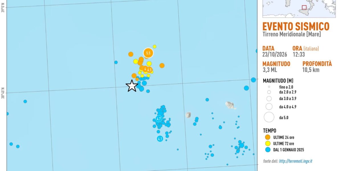
There are 30 earthquakes localized by the National Institute of Geophysics and Volcanology (Ingv), the last one at 3.55 pm with a magnitude of 4.6, in the seismic sequence underway in the southern Tyrrhenian Sea, about 30 kilometers north-west of Alicudi, in the Aeolian Islands. The count, updated at 4pm today, Friday 23 October, includes all the tremors recorded by the National Seismic Network starting from the night of 20 October.
Magnitude 5.0 and 5.5: the same earthquake
The strongest event is that of 12.19pm, which the INGV indicates with local magnitude ML 5.0 and moment magnitude Mw 5.5. The hypocenter is 9 kilometers deep. On the mainland, the towns closest to the epicenter are Malfa (62 kilometres), Leni (63) and Santa Marina Salina (66), on the island of Salina.
The two values measure the same earthquake with different methods: the local magnitude is the estimate calculated in the first minutes, the moment magnitude derives from subsequent processing and is considered more representative of the energy released by the strongest events.
In the sequence, the INGV counted two other tremors with a magnitude equal to or greater than 4: one of magnitude 4.3 at 11.51 am and one of magnitude 4.0 at 12.24 pm, five minutes after the main event. Another 14 earthquakes had magnitudes between 3.0 and 3.9.
Especially felt in the Aeolian Islands
According to the INGV, the 12:19 quake was “strongly felt in the archipelago of the Aeolian Islands” and along the northern coast of Sicily, to a lesser extent in the rest of the island and in Calabria. The data emerges from the questionnaires filled out by citizens on the “Did you feel the earthquake?” website. The shaking map, calculated with data from the INGV and Civil Protection networks, estimates effects up to degree V on the Mercalli scale in the Aeolian Islands and in a large band of northern Sicily.
An area of high seismic danger
The INGV recalls that the area is classified as highly seismic dangerous and that in recent decades several earthquakes with a magnitude greater than 4 have occurred there, including those of 7 September 2009 and 7 February 2025, both with a moment magnitude of 4.7. Last March, a little further south, a sequence of over 50 tremors developed about 15 kilometers west of Alicudi: the strongest, on the night of March 21, reached moment magnitude 4.7.
In the historical catalog of Italian earthquakes the area appears with events of magnitude equal to or greater than 5. These are two earthquakes in May 1957, of magnitude 5.2 and 5.3, and above all the one of 28 May 1980, of magnitude 5.7, which in Alicudi caused damage estimated at between VI and VII degrees on the Mercalli scale. Very deep earthquakes linked to subduction have also been recorded in the archipelago: on 5 May 2004 a 5.3 magnitude shock occurred at a depth of 255 kilometres.